Cloud-enabled GIS software with visualization dashboards and integrated city-scale geodata for smarter decision-making.
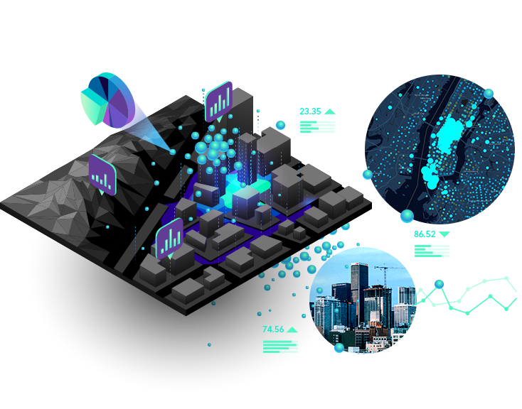
JAL provides advanced cloud-based GIS platforms designed for real-time geospatial insights and smarter decision-making. Our solutions include interactive visualization dashboards, city-scale geodata integration, and spatial analytics tailored to diverse industries. By combining precision mapping with modern cloud technology, we empower governments, enterprises, and communities to plan, monitor, and manage infrastructure with accuracy, efficiency, and transparency.
Comprehensive technology, infrastructure, and digital solutions empowering businesses with efficiency, innovation, security, and sustainable growth.
enabling real-time geospatial analysis, data management, and decision-making across multiple industries.
offering intuitive mapping, monitoring, and reporting for city-scale and enterprise-level spatial projects.
with IoT, AI, and enterprise systems to enhance accuracy, performance, and operational efficiency.
supporting massive datasets, urban planning, infrastructure management, and next-generation smart city development.
Delivering predictive insights, risk assessment, and optimized resource allocation for diverse industries worldwide.
simplifying geospatial workflows, boosting productivity, and ensuring effective collaboration among stakeholders.
Our Digital Mapping & Spatial Platforms empower organizations with advanced geospatial intelligence, enabling smarter planning, monitoring, and decision-making. From real-time data integration to intuitive visualization, our solutions are designed to support industries, governments, and smart city projects with unmatched efficiency, accuracy, and scalability.


Start your project with Jal Technology for innovative solutions, expert guidance, and reliable service that ensures your success from start to finish.
Welcome to JAL, an Omani-born technology company delivering high-impact geospatial, industrial, AI, and telecommunications solutions.
© 2025 Jal Technology All Rights Reserved.