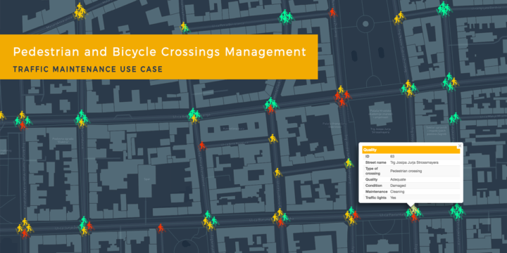
Traffic Maintenance Using GIS Cloud: Pedestrian and Bicycle Crossings Management (Use Case)
If you are a company in charge of maintaining traffic signalization, taking care of utility management or simply leading a field data collection project, online GIS solution can be of great help for your workflow. Learn how to assign your fieldworkers permissions to collect and update data about asset condition, to efficiently maintain road crossings using Mobile Data Collection App. During data collection all assets and their attributes are accessible in Map Viewer and Map Editor in real time. Now you can easily optimize maintenance process without losing extra time or money. This use case is written by a geography student Josip Cmrečnjak who also envisioned this project, created the form and collected the data necessary to perform asset maintenance. Traffic system in urban areas is…